PERU MAPS
Peru is the third largest country in South America and has among the most diverse range of habitats. Along the southern coast, the Atacama Desert ranks among the driest regions on earth, whereas the Andean altiplano is characterized by alpine habitat. The Amazon Basin region to the east of the Andes boasts Peru's highest biodiversity. |
Click below to see the Peru maps and information
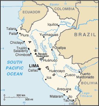
government map
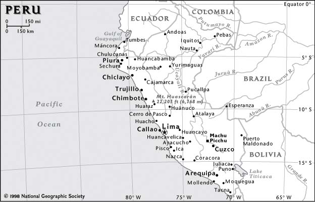
National Geographic map
GOVERNMENT MAP
return to gallery
In this map of Peru, produced by the Central Intelligence Agency (U.S. Government), the three main tributaries at the headwaters of the Amazon are shown: the Maraņon, Huallaga and the Ucayali. The main towns of the Peruvian Amazon, of which Iquitos is the biggest, are also shown. |
NATIONAL GEOGRAPHIC MAP
return to gallery
In this National Geographic map of Peru, the country's highest peak is shown. Further south in Peru along the Andes near Arequipa is the Amazon's source, discovered in 2000 by a five-nation National Geographic expedition. |
Learn more about Peru
previous maps
|
next section
|
|---|


