ECUADOR MAPS
Ecuador is South America's fourth smallest country and the most densely populated. Due to its location on the equator (hence the name), and its variety of habitats, it has among the world's highest species diversity of wildlife and plant life. |
Click below to see the Ecuador maps and information
government map
National Geographic map
GOVERNMENT MAP
return to gallery
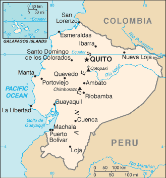
The Central Intelligence Agency (U.S. Government) map of Ecuador shows the Andes mountains that divide the country. Ecuador lacks direct access to the Amazon River, so boat traffic has to go down the Napo River, which meets the Amazon just upstream of Iquitos in Peru. (The map inset shows the Galapagos Islands.) |
NATIONAL GEOGRAPHIC MAP
return to gallery
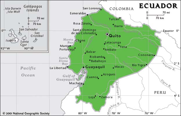
National Geographic's map of Ecuador shows some of the major towns east of the Andes, in lowland rainforest. The area around Tena is important for oil drilling, whereas the best areas for jungle tours are to the south, around Loja and Zamora. |
Learn more about Ecuador
previous maps
|
next country
|
|---|


