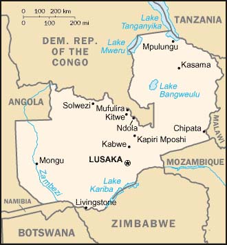
ZAMBIA MAP
Click image to return to gallery
This political map of Zambia shows the country's boundaries with neighboring countries. Zambia is entirely landlocked and relies on rail connections through Angola and Mozambique for access to sea-going ports. The two biggest cities in Zambia are the capital Lusaka, and Ndola, center of the country's copperbelt region. This map is produced by the US government and found on the US CIA website. |
Learn more about the Zambia map
previous map
|
next map
|
|---|


