MALAWI MAPS
These maps show the country of Malawi in central East Africa. These maps show how the same area can be shown in different ways to emphasize different aspects of a country's geography. |
Click below to see the images and information on Malawi maps:
political boundaries
topographical features
POLITICAL BOUNDARIES
Click image to return to gallery
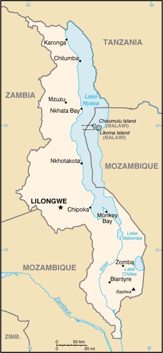
This political map of Malawi shows the country's boundaries with three neighboring countries and its major geographic feature, Lake Malawi. Note that Lake Malawi to the west is shared with Tanzania, but within the Tanzanian portion two islands are claimed by Malawi. The more important of these two is Likoma Island. (Photos from Likoma Island cathedral and people.) The two biggest cities in Malawi are the capital Lilongwe, and the commercial center Blantyre. This map is produced by the US government and found on the US CIA website. |
TOPOGRAPHICAL FEATURES
Click image to return to gallery
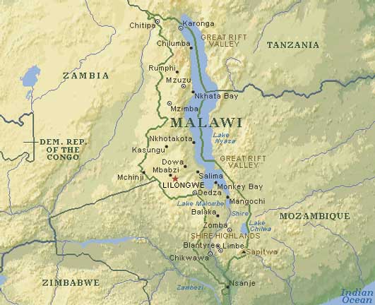
This map shows topographical variation in Malawi. The country is mountainous and rugged in the north whereas river plains, notably of the Shire River (a tributary of the Zambesi) dominate the southern half of the country. This has consequences for settlement of the land and subsequent commerce as reflected in commercial maps. |
Learn more about the Malawi map
previous map
|
next map
|
|---|


