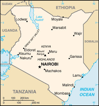
KENYA MAP
Click image to return to gallery
This political map of Kenya shows the country's boundaries with five neighboring countries and its coast with the Indian Ocean. Note that Lake Victoria to the west is shared with Uganda and Tanzania. You can see that the equator (0°) runs through the middle of the country. Various geographical features include the Great Rift Valley and Mount Kenya. The two biggest cities in Kenya are the capital Nairobi, and its largest port Mombasa. This map is produced by the US government and found on the US CIA website. |


