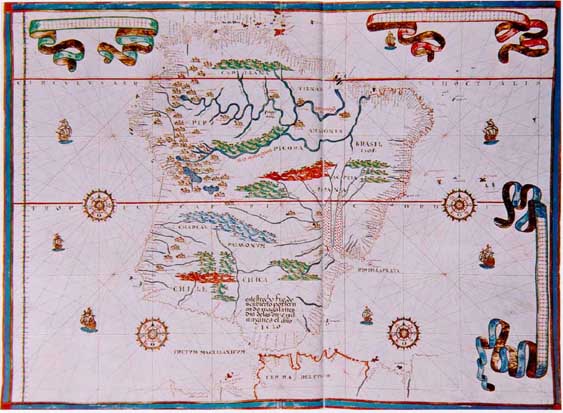
MARTINEZ 1597 MAP
return to gallery
This is one of the earliest maps to properly depict the Amazon flowing from near the west coast of South America to the river's mouth in the Atlantic. This map was made in 1597 by Joan Martinez, a famous Spanish map maker. The lower branch shown above represents the Amazon, whereas the upper branch represents the Orinoco River. The cartographer has shown a link between the two river systems, a fact that was not confirmed by German explorer Alexander von Humboldt some 200 years later. |
Learn more about the Martinez 1597 map
previous map
|
next map
|
|---|


