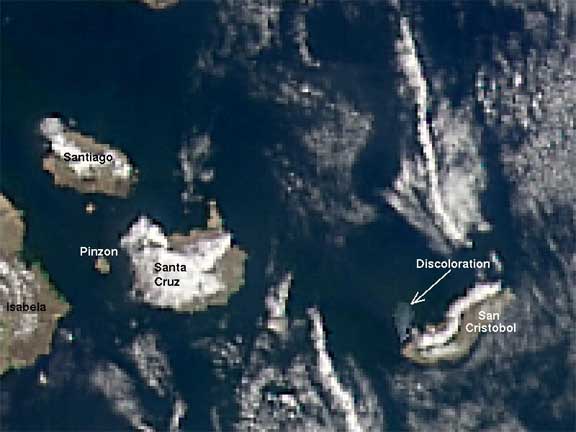
This picture of San Cristobal Island is pizelated due to the low resolution of the acquired image. Yet, the
information is invaluable. The discolored area (arrow) is caused by oil released as a result of a tanker that ran
aground about a week before the image was taken. This type of image allowed scientists to track and anticipate the
direction of the oil slick and therefore where to focus clean-up efforts. This view was taken January 21, 2001 by the
SeaWiFS satellite. (See map of oilslick.)
OrbView-2 Imagery provided by ORBIMAGE, the SeaWiFS Project and NASA/Goddard Space Flight Center. © 2002 Orbital
Imaging Corporation. All rights reserved.
|

