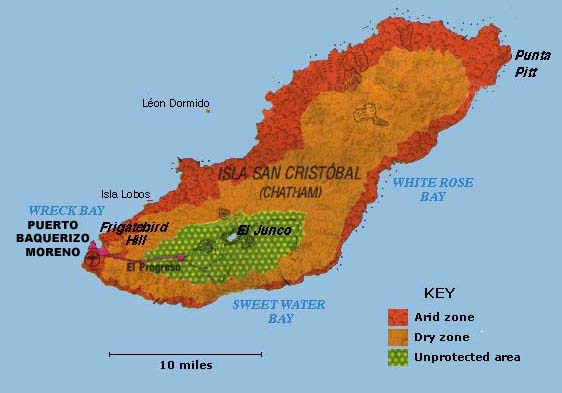
San Cristobal Island is the fifth biggest island of the Galapagos. It is lozenge-shaped, about 30 miles long
and 10 miles wide. The highest point, is 2,395 feet. Its land area is 215 square miles. It is comprised three
or four fused volcanoes—all extinct. The Ecuadorians named it San Cristóbal after Saint
Christopher, the patron saint of travelers. It is also called Chatham by English after the Earl of Chatham. It
is the only island with permanent fresh water, located near the top of the island in a small lake called El
Junco. Because of the water, the island was settled early in Galapagos history, and was the home of the
islands' governor when Darwin visited in 1835. This was Darwin's first stop in the islands. Today there are
two towns. Puerto Baquerizo Moreno is the Galapagos' administrative capital and the second biggest town, with
about 3,000 inhabitants. Most are in the small-scale fishing but some are employed in the tourist industry, and
there is also an Ecuadorian naval base here. Puerto Baquerizo has an airport with flights from the mainland
although most visitors land at Baltra. About 500 people live in El Progresso which has a rather sordid past. In
the mid-1800s a penal colony was established there for prisoners from Ecuador. This was later taken over by
Manuel Cobos who treated the convicts as slave laborers. Unsurprisingly, the convicts murdered Cobos during an
insurrection. Today the town is a sleepy farming community.
|


