RIVER TIDES MAP
Due to the very slight drop of the Amazon River, tides are able to penetrate far upstream, about 600 miles to the town of Obidos. Due to the movement of salt water in and out of the estuary region, the flora and fauna are distinct from areas where tidal effects are not found. |
Click below to see the maps and information on the river tides
mouth of the Amazon
sampling stations
MOUTH OF THE AMAZON
return to gallery
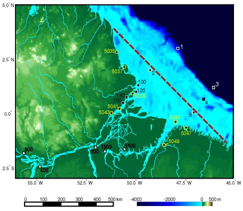
This map shows the area around the mouth of the Amazon and Para rivers. The numbers indicate
locations where tidal data is collected from NOAA and other sources). The red dashed line is
a "zero-line" used to calculate distances from this arbitrarily defined "mouth" for the fluvio-tidal systems.
The rivers and coastlines were derived from World Database II and digital topography from a scientific paper. The
bars show a distance scale (left) and elevation (right). The dark area in the upper right corner of the map
indicates where the continental shelf drops off to the deep ocean. |
SAMPLING STATIONS
return to gallery
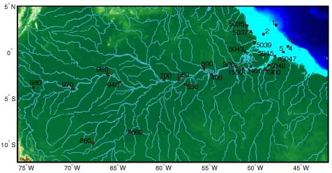
This map shows a series of sampling stations used to measure tidal flow and other changes in the
river. Stations 5035 through 5049 refer to NOAA navigational tidal stations. The distance from the
mouth of the river to the edge of the map is about 1500 miles. |
Learn more about the river tides map
previous section
|
next maps
|
|---|


