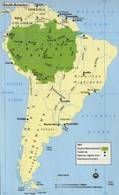
This map of the Amazon depicts the region as it is today, showing the present national boundaries.
The green area represents the watershed of the Amazon, an area about three-quarters the size of the
United States. You can see the geographical layout of the Amazon river and its tributaries. The
source of the Amazon is high in the Andes, near the west coast of the continent, up the Rio Maraņon.
This map is featured on the inside cover of The Amazon: The Bradt Travel Guide (Bradt Publications,
1998, 2003).
|


